OC Explained: Maps

✨ Creating a great transit map is both an art and a science!
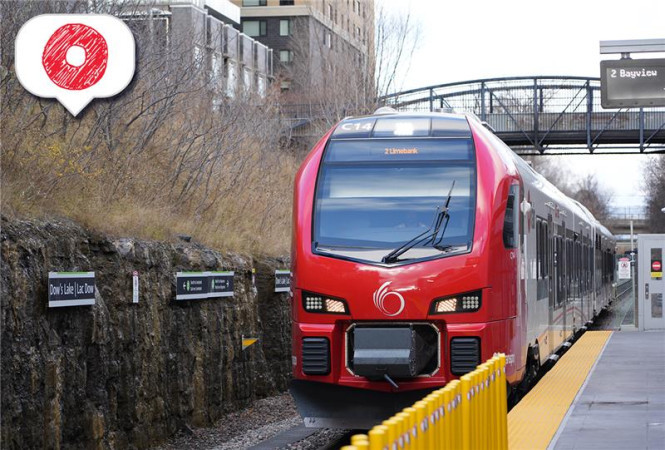
OC Transpo’s transit network spans 420 km², includes three O-Train lines, 59 transit stations, over 100 bus routes, 28 Park & Ride lots, and nearly 5,800 bus stops.
Bus, rail and Para Transpo operators help you get to where you need to be. Our graphic designers and cartographer help ensure you can navigate our network by creating easy-to-read transit maps.
The Next Stop Blog caught up with OC Transpo’s cartographer and graphic design team to learn more about the history of transit maps, how they are created, and the work that is underway to prepare for New Ways to Bus.
OC Transpo’s maps
Maps are a key part of understanding and using our transit network.
They can be found across our transit system, both at stations, bus shelters, some stops, and in your pocket via your smartphone.
Whether you're getting from one end of the city to another or trying to navigate a transit station, OC Transpo has different types of maps to help you ride:
Network map
Train lines and bus routes are organized by service types. Each type has its own colour and symbol telling you when and where a route travels. Route numbers are organized geographically and indicate where a bus travels, and if it connects to the O-Train. These symbols also help you identify your route more easily on a map and follow it when planning a trip.
_BRT_27April2025_V1_Web_Map.png)
Route maps
Route maps provide a level of detail that is not possible on system maps. They focus on the streets used by individual bus routes and highlight some of the key destinations served.
In some cases, these maps also show special trips that only run in some time periods or on some street segments. Route maps can be found at bus stops in your neighbourhood and accessed online to help you plan your trip in advance.
Route maps originated in the early 1960s and at that time there were only a small number of route maps in a vertical format.
The same format is used in today’s version. This allows them to be inserted easily in our route director box, the one you see on the flagpole at many bus stops. You will also find them on our website.

We also have maps that show frequent routes, connexion routes and night service.
Interactive map
In 2024, OC Transpo introduced a dynamic new way to explore the future of transit in Ottawa. Our interactive system map brings the city’s next O-Train extensions to life. It connects future stations, Park & Rides, and major destinations in one intuitive, scrollable view.
This map was custom built using OpenStreetMap, MapTiler, and custom development. The goal was to create a mobile-friendly map that is responsive, layered with helpful features, and soon to be 100% accessible. To make the experience even easier, we created a How to get started guide so that anyone, from first-time users to seasoned commuters, can explore what’s next with confidence.

Station maps
Over the years, our transit stations have become more complex and multilevel with the opening of O-Train Line 1. To help you find the train platform, an elevator, a bus stop, or even a washroom, we have 3D maps of transit stations.

Detour maps
Alongside our regular service maps, our Web team produces clear, easy-to-read detour maps for any planned closures or special events. These maps are designed to help all customers, especially those who prefer visual information, understand temporary route changes and plan their trips with confidence.
Each detour map is:
- Tailored to the specific disruption
- Designed for quick understanding
- Published with a clear table and written description to ensure riders can access the information in multiple ways.
While we aim to publish detour maps whenever possible, there may be times when road closure details are finalized too close to implementation. In those cases, a map may not be produced, but we’ll always ensure the most accurate and timely information is shared through service alerts and rider messaging.

Places of interest
Places of interest maps have been created for all O-Train stations. Not only do they help you locate the station, but they also identify key destinations and landmarks that are within walking distance of each station. These maps can be found online and in person at O-Train stations.

Map of Places of Interest near Rideau Station
Travel Planner map
Using our Travel Planner map, you can:
- Plot the route for your trip
- View the scheduling times for your trip
- Pinpoint locations for your bus stops using satellite and street view maps.

What is the process for maintaining transit maps?
Updating and maintaining our maps is a never-ending job. We have approximately 500 different maps that need to be updated as our transit network evolves.
Service changes, new housing or commercial developments, or construction can lead to changes to transit routes. Our team is constantly monitoring the system and tracking ridership to deliver the best possible service.
Ensuring our maps are up to date is a never-ending job, with updates being made to match our service changes which take place four times a year. When construction season hits, some bus routes may have to be placed on detour.
Route changes are confirmed by our planning team. Ridership data, travel patterns, customer feedback, and staff observations are used to inform route design decisions. When a bus route is updated, planners will share changes with the graphic design and mapping team who begin updating maps.
Using digital tools such as Adobe Illustrator and InDesign,draft maps are created with the help of data from OpenStreetMap, Google Maps and GeoOttawa. We then begin a rigorous quality assurance process to ensure everything is accurate and accessible.
Once a map has been approved, we move to the next phase of getting them into your hands both physically and digitally through publishing.
Physical maps are installed at bus shelters and stations. We work with outside companies to help with printing. Once printed, maps are handed over to our maintenance teams who set out across the city updating bus stops, shelters, stations, and other key locations.
For digital maps found online, revised maps are sent to our web team, who ensure every individual file is renamed and uploaded to the appropriate webpage.
All maps are provided in multiple formats, including PDFs and high-quality PNGs, for ease of use across devices. Schedules and maps are one of the most visited sections of our website, receiving more than 1.5 million views in 2024.
Once published, the process begins all over again preparing for the next service change.
Evolution of transit map creation
Transit maps weren’t always at the fingertips of customers. While they could be found in annual reports and studies in the first half of the 20th century, the first regular distribution of maps from the Ottawa Transit Commission began in 1952.
The OTC Rider was a rider guide and was first published on December 31, 1952. For two full years, the OTC informed their customers every two weeks with a print handout that included a published map of the bus and streetcar network. In all, 24 maps were published in the OTC Rider.

OC Transpo hired its first cartographer in January 1986. Prior to this date, OC Transpo had an in-house graphic artist but no dedicated cartographer as the development of transit maps was outsourced. With a rapidly growing transit network, OC Transpo hired a dedicated cartographer to complement the existing team as the transit network rapidly expanded.
Transit maps were created by overlaying tracing paper on a city map and routes were drawn by hand with an ink pen known as a Leroy Pen. This tool acted as a lettering stencil before the advent of digital design tools.
Maps traced on paper were then outsourced to be scanned digitally to create a final digital file. In many instances, silkscreen printing was the method of choice to print huge quantities of maps on vinyl.

Tools over the year began to replace each other as designers shifted from Leroy pens to more sophisticated label creators and lettering machines.
While service changes took place four times a year, the fall service change was the most prominent. Service frequency would change throughout the year to match ridership volumes as they do today, however, major route changes typically would take place in the fall. There would be a major push every summer to finalize the map to ensure printed copies were in place across the transit system at the end of summer vacation and before the school year began.
With new digital tools becoming available to the public, the creation of transit maps transitioned to digital in 1994. Since then, better software has allowed maps to fully be edited digitally in-house, cutting down on the time required to design and edit them.
In the second half of the 90s, home Internet access was on the rise. Search engines could help find valuable information previously found in books, or by picking up the telephone. In 1996, OC Transpo registered its domain name, octranspo.com, to provide information to customers at their fingertips, including digital transit maps.
With the prominence of home computers, tablets and smartphones, the need for maps extended beyond physical copies at stations and bus stops to virtual options that can be viewed on a smartphone’s smaller screen.
Station maps have also changed significantly over the years. Transitway stations were mostly single level and could be conveyed using a top-down view. In 2019, with stations becoming more complex with multiple levels, station maps received a long due makeover and shifted to becoming three-dimensional using more sophisticated graphic design techniques.


Accessibility is a key consideration for the creation of all maps. In 2005, the Accessibility for Ontarians with Disabilities Act (AODA) came into existence. We strive to meet accessibility standards wherever and whenever possible with our maps and all graphic design products. This guides many of the map elements including colours, symbols, font sizes, and how graphics are viewed online.
Preparing for New Ways to Bus
New Ways to Bus is OC Transpo’s new bus network that will focus on frequency, local service in your neighbourhood, and connections to key destinations. With the opening of O-Train Lines 2 and 4 forming new connections in the south, many routes have been redesigned to be more efficient while taking advantage of O-Train Lines 1, 2 and 4.
With more than 125 bus routes being changed, replaced, or newly introduced, every neighbourhood and most customers will see changes to their trip when we launch the new network on April 27.
The full list of route changes is visible on our website, where you’ll find additional information on replacement service, connections to the O-Train, maps, and more.
Our graphic design team is working to produce new maps that reflect the New Ways to Bus network and individual routes. From individual routes to the entire system, thousands of maps need to be designed, printed, and installed at locations across the city. There are 1,800 transit shelters across the city that will see new maps installed and 2,000 bus stops that will see route maps printed and installed.
Transit Maps over the years
Maps of Ottawa’s transit system have come a long way over the past 150 years. From horse-drawn carriages, to streetcars, to buses, to trains, our maps act as a timestamp showing the important places that people are travelling to.
Scroll through the gallery below to see maps from the past 100 years to get a glimpse of the evolution of Ottawa’s transit system:
Photo gallery


Dot 1 Dot 2 Dot 3 Dot 4 Dot 5 Dot 6 Dot 7 Dot 8
In the 1920’s, public transit was provided by the Ottawa Electric Railway Company. Service spanned from Rockcliffe in the east, Britannia beach in the west, Grove Avenue in the south, and Hull in the north. They were responsible for a fleet of 130 streetcars, 61 buses, service vehicles, buildings, and power plants. This image depicts the network in 1929.
Ottawa’s transit system was operated by the Ottawa Electric Rail Company up until 1948 when the Ottawa Transportation Commission was formed. After 78 years of privately-run transport, the City purchased the Ottawa Electric Railway Company for $6.3 million or the equivalent of $90 million in 2025 dollars. This image depicts the network in 1948.
In November 1954, the Ottawa Transit Commission announced the debut of four large maps being available to the public at four busy locations throughout Ottawa for visitors to the city who weren’t familiar with taking transit. Streetcars, an essential part of daily life for 68 years, stopped running on Ottawa streets in 1959. The last in-service streetcar completed its final trip on the Britannia line in the early morning hours of May 1. This image depicts the network in 1954.
In the late 1960s, Ottawa grew into outlying rural communities. Bus routes did not yet reach these new, suburban neighbourhoods, and the streets were packed with automobiles during rush hour. Many quality-of-life improvements for riders were introduced during this decade. Some of the improvements that you can still see in use today include route signs in the back window of buses, detailed route maps available to everyone, informative bus stop signs, and bus stop shelters. This image depicts the network in 1967.
A new look and name came for transit in Ottawa in the 1970s. The Ottawa-Carleton Regional Transit Commission took over in 1972 and the following year called the service OC Transpo.
In 1981, OC Transpo debuted individual route maps at bus stops across the city. This image is an example of one of the first route maps in the early 1980s.
In the 1980s, plans were formalized to establish the Transitway, a bus rapid transit system that would connect the different corners of this growing city through a series of transit corridors. This new Transitway connected downtown Ottawa to routes heading west, southwest, and southeast. The first Transitway opened in Fall 1983. This image depicts the network in 1983.

Forty-two years after the removal of streetcars, Ottawa returned to rail in 2001. On October 15, the O-Train began service as a pilot project in the newly amalgamated City of Ottawa. The eight-kilometre line with five stations ran from Bayview Station to Greenboro Station. The route travelled through residential neighbourhoods and served important landmarks, including Carleton University. This image depicts the network in 2001.
On September 14, 2019, O-Train Line 1 opened to the public welcoming riders for the first time at 13 brand-new, fully accessible stations and adding 12.5 kilometres of electric rail service to OC Transpo’s network. Three weeks later, OC Transpo launched the largest service change ever to connect the bus network with Line 1. More than 100 bus routes were adjusted to connect directly to the train from every corner of the city. Before opening Line 1, a brand-new system map was born introducing the new “service type” route colours and symbols in use today on maps and signage. The following image depicts our network in 2019.
On January 6, 2025, O-Train Lines 2 and 4 launched extending the O-Train system farther south to Limebank Station on Line 2 and Airport Station on Line 4. On April 27, OC Transpo will launch New Ways to Bus, which includes changes to more than 100 routes and will open up new convenient connections across the city. A core part of the New Ways to Bus network is the Frequent routes that will run seven days a week along main roads, including every 15 minutes or less on weekdays. The new symbol for Frequent routes will be a blue hexagon.