New Ways to Bus
Frequent. Local. Connected.
Overview
New ways to bus are coming to Ottawa! OC Transpo's new bus network will focus on frequency, local service in your neighbourhood, and connections to key destinations.
New Ways to Bus includes more than 100 routes and is planned to launch following the opening of O-Train Lines 2 and 4 in the south, opening up new convenient connections across the city. Every neighbourhood and most customers will see changes to their trip.
The new network is a key part of OC Transpo’s 5-Year Roadmap and is based on the results of the 2023 Bus Route Review. New Ways to Bus meets the Council-approved Transit Services budget. It is a big step towards our goal of increasing bus service reliability to 99.5 per cent, alongside the Bus Maintenance Action Plan and ongoing employee recruitment efforts.
Your new bus network
This new bus network of more than 100 routes will ensure that our city has a sustainable network that meets the evolving needs of our customers:
- 27 Frequent routes that run seven days a week, including every 15 minutes or less during the weekdays.
- 58 Local routes designed to take you to neighbourhood destinations and transit hubs where you can connect with Frequent routes and the extended O-Train network.
- 17 Connexion routes that provide fast, peak-period connections to the O-Train.
New Ways to Bus Travel Planner
Sample days containing New Ways to Bus routes and schedules are now in the New Ways to Bus Travel Planner!

New Ways to Bus Network map
_13May2024_V3.png)
What's changing?
You will see a shift from downtown-focused bus routes to routes that improve connections to community hubs and key destinations.
Some customers may have to go further to the bus stop, have additional transfers to buses or trains, and/or have faster travel times.
In addition to fewer Connexion routes, some routes will be retired due to low ridership and to improve connections to new routes and the O-Train. Retired routes will be replaced with alternative service nearby.
At this time, there will be no changes to existing 300-series Shopper routes and 400-series Event routes. In some instances, there may be changes to 600-series School routes. These changes will result in comparable service for students and will not impact the current school year. Please keep checking the website for updates on 600-series and Night routes.
Bus route symbol and colours, also known as service types, will be updated to reflect the New Ways to Bus network:
| Current | New |
|---|---|
|
The Rapid Route service type (blue circle) will be removed. |
|
|
The new symbol for Frequent routes will be a blue hexagon. As a core part of the New Ways to Bus network, service will continue to:
|
|
|
Local service will continue to provide custom routing to local destinations. Many local routes are being redesigned to better serve neighbourhood destinations and transit hubs where you can connect with Frequent routes and the extended O-Train network. |
|
|
Connexion routes will provide quick, convenient connections to O-Train.
|
On-street signage
In the coming weeks, you may begin to notice changes to signs or maps at bus stops. This change is to prepare for the launch of our New Ways to Bus network. With thousands of bus stops requiring changes, we need to begin updating this information early so it’s ready in time for the launch of the new bus network.
Signs and maps for the new bus network will be covered or have stickers and notices to indicate that they aren’t in effect yet. Covered signs will be unveiled right before the new network comes into effect.

Routes that will not change
While some of these routes may have a change in their service type and symbol, there will not be any changes made to their routing:
- 6 New Frequent Route
- 14 New Frequent Route
- 19 Local Route
- 21 Limited Local route
- 23 Limited Local Route
- 26 Limited Local Route
- 38 Limited Local Route
- 42 Limited Local Route
- 44 New Frequent Route
- 45 New Frequent Route
- 47 Limited Local Route
- 51 Local Route
- 56 Local Route
- 57 New Frequent Route
- 67 Limited Local Route
- 84 Limited Local Route
- 87 New Frequent route
- 90 New Frequent Route
- 98 New Frequent Route
- 139 Limited Local Route
- 158 Limited Local Route
- 221 Connexion Route
- 222 Connexion Route
- 228 Connexion Route
- 262 Connexion Route
- 277 Connexion Route
Routes that will be replaced, changed, or introduced
Several routes will be shortened, extended, or adjusted, and some routes will be removed. Routes that have been shortened or removed may be replaced by another route. Routes that will be extended may replace removed routes or the removed portion of another route.
A few routes will be renumbered, either with the exact same routing remaining in place, or with minor adjustments. Additionally, some entirely new bus routes will be introduced.
Select a bus route to see how it will change or be introduced:
Route 5 New Frequent Route
Details
Will run between Waller (formerly Laurier) and Elmvale Station.
- Will replace Route 55 service along Main Street, Smyth Road and to CHEO and The Ottawa General Hospital Campus.
- Service on Riverdale Avenue to Billings Bridge Station will be replaced by Route 18.
O-Train connections
1 Line 1 Route Rideau Station
Route 7 New Frequent Route
Details
Peak period service on Brittany Drive will be replaced by service on Routes 17 & 20.
O-Train connections
1 Line 1 Route St-Laurent, Rideau, and Parliament stations
Route 8 Local Route
Details
New route will run between the Canadian Museum of History in Gatineau and Dow’s Lake Station.
- Will replace service to/from Gatineau on Routes 15, 61, 63, 75, and 85.
- Will run on Rue Laurier, Boulevard des Allumettières, Boulevard Maisonnueve, Eddy Street, Rue Laurier, Terrasses de La Chaudière, Rue Laurier, Eddy Street, Booth Street, Albert Street, and Preston Street.
Will extend to the Experimental Farm during summer weekends, replacing Route 185.
O-Train connections
1 Line 1 Route Pimisi Station
2 Line 2 Route Corso Italia and Dow's Lake stations
Route 9 Local Route
Details
Will run eastbound on Murray Street instead of Boteler Street.
Service extended south along Sussex Drive and shortened along Dalhousie Street.
O-Train connections
1 Line 1 Route Rideau and Hurdman stations
Route 10 New Frequent Route
Details
Will be extended to run between Hurdman Station and Main Street (Saint Paul University).
- Will replace Route 16 service from Lyon Station east to Main Street.
O-Train connections
1 Line 1 Route Lees, Rideau, Parliament, Lyon, and Hurdman stations
2 Line 2 Route Mooney's Bay and Carleton stations
Route 11 New Frequent Route
Details
Will run between Waller (formerly Laurier) and Bayshore Station, but will be changed to:
- Serve Ambleside Drive instead of Richmond Road.
- Serve Bayswater Avenue, Scott Street, and Preston Street instead of Somerset Street.
- Run in the eastbound direction on Queen, O’Connor, and Slater streets to Mackenzie King Bridge.
O-Train connections
1 Line 1 Route Tunney's Pasture, Bayview, Parliament, and Rideau stations
Route 12 New Frequent Route
Details
Will be extended west to run between Blair and Tunney's Pasture stations.
- Will follow current Route 16 service at Lyon Station, Albert Street and Scott Street.
O-Train connections
1 Line 1 Route Tunney's Pasture, Bayview, Pimisi, Lyon, Parliament, Rideau, and Blair stations
2 Line 2 Route Bayview Station
Route 13 Limited Local Route
Details
New route will run between the Canadian Museum of History in Gatineau and Tunney’s Pasture Station on weekdays during peak periods.
- Will replace service to/from Gatineau on Routes 15, 61, 63, 75, and 85.
- Will serve Rue Laurier, Boulevard des Allumettières, Boulevard Maisonnueve, Eddy Street, Rue Laurier, Terrasses de La Chaudière, Rue Laurier, Eddy Street, Booth Street, Albert Street, and Scott Street.
O-Train connections
1 Line 1 Route Tunney's Pasture, Bayview, and Pimisi stations
2 Line 2 Route Bayview Station
Route 15 Limited Local Route
Details
Will be shortened to run between Parliament and Blair stations.
- Service to/from Gatineau will be removed and replaced by new Routes 8 and 13.
O-Train connections
1 Line 1 Route Parliament, Rideau, and Blair stations
Route 16 Local Route
Details
Will be removed and replaced by:
- Route 10 between Lyon Station and Main St. / St. Paul’s University
- Route 12 between Lyon and Tunney’s Pasture stations
- Route 81 between Tunney’s Pasture and Westboro stations
O-Train connections
See Routes 10, 12, and 81.
Route 17 Limited Local Route
Details
New route will run between Parliament Station and Wateridge Village, replacing Route 27:
- Will run on Rideau Street, Montréal Road, St-Laurent Boulevard, Brittany Drive, Montréal Road, Wanaki Road, Mikinak Road, and Codd’s Road.
O-Train connections
1 Line 1 Route Parliament and Rideau stations
Route 18 Local Route
Details
Will be changed to run between St-Laurent and Billings Bridge stations.
- Will no longer serve Parliament Station.
- Will replace current Route 5 service to/from Billings Bridge Station and will run on Bank Street, Riverdale Avenue, Main Street, Hawthorne Avenue, Elgin Street, and Rideau Street.
O-Train connections
1 Line 1 Route Rideau and St-Laurent stations
Route 20 Local Route
Details
Will be extended to run between Rideau and St-Laurent stations.
- Service on St-Charles Street, Barrette Street, and Loyer Street will be removed.
- Will run along Beechwood Avenue and St-Patrick Street and follow Route 6 service between St-Patrick Street and Rideau Station.
O-Train connections
1 Line 1 Route Rideau and St-Laurent stations
Route 24 Local Route
Details
Will be changed to run between St-Laurent Station and Chapel Hill Park & Ride in both directions and run on Jasmine Crescent and Loyola Avenue instead of Ogilvie Road and Eastvale Drive:
- Will run on Loyola Avenue, Shefford Road, Montréal Road, St-Joseph Boulevard, Bearbrook Road, Westpark Drive, Ridgeburn Gate, Eastpark Drive, Innes Road, Navan Road, Brian Coburn Boulevard, Renaud Road, Compass Street, Axis Way, and Fern Casey Street.
Service along Innes Road, Eastpark Drive, Bearbook Road and Westpark Drive will replace Route 28 in Blackburn Hamlet.
O-Train connections
1 Line 1 Route St-Laurent and Blair stations
Route 25 New Frequent Route
Details
Will be extended to run between Millennium Station and Wateridge Village.
- Service on Matheson Road, Charlton Drive, Plumber Avenue will be removed.
- Will run on Bathgate Drive.
- Will replace Route 27 service on Montréal, Wanaki, Mikinak, Codd’s, and Carson’s roads.
Weekend service between Blair Station and the Canadian Aviation and Space Museum will be removed and replaced by Route 125.
O-Train connections
1 Line 1 Route Blair Station
Route 27 Limited Local Route
Details
Will be removed and replaced by:
- Route 17 between Parliament Station and Wateridge Village.
- Route 25 between Wateridge Village and Blair Station.
O-Train connections
See Routes 17 and 25.
Route 28 Local Route
Details
Will be removed and replaced by Route 24 with service along Innes Road, Eastpark Drive, Bearbrook Road, and Westpark Drive in Blackburn Hamlet.
O-Train connections
See Route 24.
Route 30 Local Route
Details
Will continue to run between Blair and Millenium stations, but all trips will run on Montmère Avenue all day.
O-Train connections
1 Line 1 Route Blair Station
Route 31 Local Route
Details
Will run between Place d'Orléans Station and Tenth Line Road:
- Service to Centrum Boulevard, Tompkins Avenue, and Princess Louise Drive will be replaced by Route 33.
- Service to Fallingbrook and Queenswood Heights will be removed and replaced by Route 36 on Innes Road, des Épinettes Avenue, Charlemagne Boulevard, to Place d’Orléans.
- Service on Charlemagne Boulevard, des Épinettes Avenue and Jeanne d'Arc Boulevard will be replaced by Route 130.
- Will replace Route 131 between Youville Drive and Innes Road and Route 34 between St-Joseph Boulevard and Jeanne d’Arc Boulevard.
O-Train connections
Not applicable.
Route 32 Limited Local Route
Details
Will be changed to provide service at the westbound bus stop on Brian Coburn Boulevard, at Chaperal Private, for closer service to the Aline-Chrétien Health Hub.
O-Train connections
1 Line 1 Route Blair Station
Route 33 Local Route
Details
Will be changed between Tenth Line Road and Place d'Orléans Station:
- Will run on Tompkins Avenue, Chartrand Avenue, Duford Drive, and Place d'Orléans Drive.
O-Train connections
1 Line 1 Route Blair Station
Route 34 Local Route
Details
Will be changed to serve Chapel Hill Park & Ride:
- Will run along Navan Road and Brian Coburn Boulevard.
O-Train connections
1 Line 1 Route Blair Station
Route 35 Local Route
Details
Will be changed and extended to run between Blair Station and Sweetvalley Drive with service on Harvest Valley Avenue.
- Will serve the full length of Bottriel Way.
- Service on Merkley Drive will be removed.
- Service on Charlemagne will be replaced by Route 36.
- Service along Lakeridge Drive north of Harvest Valley Avenue will be removed.
O-Train connections
1 Line 1 Route Blair Station
Route 36 Local Route
Details
New route will run between Place d'Orléans Station and Innes Boulevard.
- Will replace Route 131 service on Innes Road, Jeanne d'Arc Boulevard, des Épinettes Avenue, Charlemagne Boulevard, Tenth Line Road, and St-Joseph Boulevard.
- Will run on Tenth Line Road, north of Tompkins Avenue, and on Centrum Boulevard between Tenth Line Road and Place d’Orléans Station.
O-Train connections
Not applicable.
Route 37 Limited Local Route
Details
Will be removed and replaced by:
- Route 31 on du Grand Bois Avenue and Innes Road.
- Route 35 on on Prestone Drive and Centrum Boulevard.
- Route 36 on des Épinettes Avenue and Jeanne d’Arc Boulevard.
- Route 234 on Chartrand Avenue, Duford Drive, Gleneagles Avenue, St. Georges Street, and Prestwick Drive between des Épinettes Avenue and du Grand Bois Avenue.
O-Train connections
See Route 35.
Route 39 New Frequent Route
Details
Peak period trips to/from La Cité will be removed and replaced by service on Route 25.
O-Train connections
1 Line 1 Route Blair Station
Route 40 New Frequent Route
Details
Will be changed south of St-Laurent Boulevard to run on Conroy Road, Queensdale Avenue, Albion Road, Bridle Path Drive, Hunt Club Road, and Transitway to Greenboro Station.
O-Train connections
1 Line 1 Route St-Laurent Station
2 Line 2 Route Greenboro and South Keys stations
4 Line 4 Route South Keys Station
Route 41 New Frequent Route
Details
New route will run between St-Laurent and Billings Bridge stations.
- Will replace current Route 46 on Walkley and Heron roads.
- Will serve St-Laurent Boulevard, Elmvale Acres Shopping Centre, Russell Road, Southvale Crescent, Russell Road, Walkley Road, Heron Road, Clementine Boulevard, Bélanger Avenue, and Bank Street.
O-Train connections
1 Line 1 Route St-Laurent Station
Route 43 Limited Local Route
Details
New route will run between Greenboro Station and Karsh Drive.
- Will replace current Route 40 service along Johnston Road and Karsh Drive.
- Will serve South Keys Station, Hunt Club Road, Dazé Street, Cahill Drive, Southgate Road, Johnston Road, Tapiola Crescent, Johnston Road, Blohm Drive, Karsh Drive, and Lorry Greenberg Drive.
O-Train connections
2 Line 2 Route Greenboro and South Keys stations
4 Line 4 Route South Keys Station
Route 46 Local Route
Details
Will be removed and replaced by:
- Route 41 on Walkley and Heron roads
- Route 48 on Coronation Avenue, Russell Road, and Southvale Crescent
O-Train connections
See Routes 41 and 48.
Route 48 Local Route
Details
Will be extended to run between Hurdman Station and Carleton University.
- Will run along Industrial Avenue, Coronation Avenue, Russell Road, Smyth Road, and St-Laurent Boulevard to Elmvale Acres Shopping Centre. Will serve Southvale Crescent instead of remaining on Russell Road, then serve Bank Street, Billings Bridge Station, Bank Street, and Sunnyside Avenue to Carleton University.
- Will replace current Route 46 on Coronation Avenue, Russell Road, and Southvale Crescent.
Service along the Transitway between Billings Bridge and Hurdman stations will be removed.
O-Train connections
1 Line 1 Route Hurdman Station
Route 49 Local Route
Details
Will be changed to run on Riverside Drive and Bank Street to Billings Bridge Station. Service on the Transitway between Riverside and Hurdman stations will be removed.
O-Train connections
Not applicable.
Route 50 Local Route
Details
Will be removed and replaced by:
- Route 51 on Churchill Avenue North between Dovercourt Avenue and Clare Street.
- Route 53 between Baseline Road / Clyde Avenue and Clyde Avenue North / Laperriere Avenue.
- Route 81 along Iris Street, Navaho Drive, Maitland Avenue, and Clyde Avenue to Baseline Road.
- Route 85 along Carling Avenue between Clyde Avenue North and Churchill Avenue North.
- Route 88 along Baseline Road between Erindale Drive and Clyde Avenue.
Transitway service between Iris and Lincoln Fields stations and between Westboro and Tunney’s Pasture stations.
Route 53 Local Route
Details
Will be extended to run between Baseline and Tunney’s Pasture stations.
- Will run along Laperriere Avenue, Woodward Avenue, Maitland Avenue, Clyde Avenue, Merivale Road, Woodfield Drive, Medhurst Drive, and Woodroffe Avenue.
O-Train connections
1 Line 1 Route Tunney's Pasture Station
Route 54 Local Route
Details
Will be removed.
Alternate bus service is available along Scott Street and at Tunney’s Pasture Station.
Route 55 Limited Local Route
Details
Will be removed. Service on:
- Carling Avenue, Bronson Avenue / Booth Street, Catherine Street / Chamberlain Avenue / Isabella Street, Hawthorne Avenue, and Lees Avenue will be replaced by Route 85.
- Main Street and Smyth Road will be replaced by Route 5.
O-Train connections
See Route 85.
Route 58 Local Route
Details
Will be changed to run between Crystal Bay and Bayshore Station.
- Service on Iris Street will be removed and replaced by Route 81.
- Service on Morrison Drive will be removed and replaced by Route 82.
O-Train connections
See Routes 81 and 82.
Route 60 Local Route
Details
New route will run between Kanata South and Terry Fox Station, with peak period extensions to Tunney's Pasture Station.
- Will run from 760 Eagleson Road (Real Canadian Superstore), on Eagleson Road, Romina Street, Fernbank Road, Terry Fox Drive, Castlefrank Road, Kanata Avenue, and Lord Byng Way to Terry Fox Station.
O-Train connections
1 Line 1 Route Tunney's Pasture Station
Route 61 Frequent Route
Details
Service to/from Gatineau will be removed and replaced by new Route 13.
O-Train connections
1 Line 1 Route Tunney's Pasture Station
2 Line 2 Route Bayview Station
Route 62 Frequent Route
Details
Will be changed between Terry Fox Station and Huntmar Drive to run on Campeau Drive instead of Palladium Drive.
- Service on Castlefrank Road, Katimavik Road, Palladium Drive, and Cyclone Taylor Boulevard will be replaced by changed Route 162.
O-Train connections
1 Line 1 Route Tunney's Pasture Station
Route 63 Frequnet Route
Details
Service to/from Gatineau will be removed and replaced by Route 13.
Will be changed to run on Klondike Road between Halton Terrace and Marconi Avenue, and on Halton Terrace between Klondike Road and March Road.
Service along Shirley's Brook Drive, Helmsdale Drive, and Morgan's Grant Way will be replaced by changed Route 110.
O-Train connections
1 Line 1 Route Tunney's Pasture Station
Route 64 Frequnet Route
Details
Will be removed:
- Service on Halton Terrace between Flamborough Way and Brady Avenue, on Brady Avenue, Old Second Line Road, Innovation Drive, Hines Road, and Solandt Road will be replaced by Route 110.
- Service on Halton Terrace between Klondike Road and March Road replaced by Route 63.
O-Train connections
See Routes 63 and 110.
Route 66 Limited Local Route
Details
Will be changed to run between Tunney's Pasture and Innovation stations.
- Service to/from Gatineau will be removed and replaced by new Route 13.
- Service on Leggett Drive and Solandt Road will be removed.
O-Train connections
1 Line 1 Route Tunney's Pasture Station
Route 68 Frequent Route
Details
New route will run between Terry Fox and Baseline stations.
- Will replace current Route 88 between Terry Fox and Baseline stations.
- Will run on John Sutherland Drive to directly serve the Queensway-Carleton Hospital campus.
O-Train connections
Not applicable.
Route 70 Local Route
Details
New route will replace Route 170 and run between Fallowfield Station and Limebank stations.
- Will have special trips between Fallowfield Station and the Canadian Food Inspection Agency (CFIA) on Fallowfield Road and the Canadian Food Inspection Agency.
O-Train connections
2 Line 2 Route Limebank Station
Route 73 Local Route
Details
Will be extended to run between Limebank and Tunney’s Pasture stations.
- Will run on Cresthaven Drive, Strandherd Drive, and Earl Armstrong Road.
- Will be changed between Fallowfield Station and Leikin Drive to run on Transitway, Oriska Way, Mountshannon Drive, and Longfields Drive.
O-Train connections
1 Line 1 Route Tunney's Pasture Station
2 Line 2 Route Limebank Station
Route 74 Frequent Route
Details
Will run on Earl Armstrong Road and be extended to run between Limebank and Tunney’s Pasture stations.
O-Train connections
1 Line 1 Route Tunney's Pasture Station
2 Line 2 Route Limebank Station
Route 75 Frequent Route
Details
Service to/from Gatineau will be removed and replaced by new Route 13.
Will be extended south of Kilbirnie Drive on River Mist Road, Cappamore Drive, and Greenbank Road.
O-Train connections
1 Line 1 Route Tunney's Pasture Station
Route 80 Frequent Route
Details
Service on Beatrice Drive and Chapman Mills Drive will be removed.
- Will run on Strandherd Drive and Woodroffe Avenue.
- Service along Auriga Drive, Antares Drive, Deakin Street, and MacFarlane Road will be removed and replaced by changed Route 86 and Route 117.
O-Train connections
1 Line 1 Route Tunney's Pasture Station
Route 81 Local Route
Details
Will be extended to run between Tunney's Pasture and Bayshore stations.
- Will run on Baseline Road, Clyde Avenue, Maitland Avenue, Erindale Drive, Navaho Drive, and Iris Street.
Will be changed between Westboro and Tunney’s Pasture stations to replace current Route 16.
- Will run on Churchill Avenue, Lanark Avenue, Ellendale Crescent, Clearview Avenue, Keyworth Avenue, Amanda Avenue, Northwestern Avenue, and Scott Street.
Service within Westgate Shopping Centre will be removed.
O-Train connections
1 Line 1 Route Tunney's Pasture Station
Route 82 Local Route
Details
Will be changed to run between Baseline and Lincoln Fields stations.
- Will be changed to run from Greenbank Road on Baseline Road, Morrison Drive, Pinecrest Road, and Carling Avenue.
- Peak period trips extended to Tunney's Pasture Station.
Service between Bayshore Station and Pinecrest Station will be removed and replaced by changed Route 81.
O-Train connections
1 Line 1 Route Tunney's Pasture Station
Route 83 Local Route
Details
Will be removed and replaced by:
- Route 53 between Viewmount Drive and Baseline Station
- Route 116 between Baseline Station and Antares Drive on Sundays
O-Train connections
Not applicable.
Route 85 New Frequent Route
Details
Will be changed to run between Bayshore and Lees stations.
- Service along Preston Street, Albert Street, Booth Street, to Gatineau will be removed and replaced by new Route 8.
- Will run on Carling Avenue, Bronson Avenue/Booth Street, Catherine Street/Chamberlain Avenue/Isabella Street, Hawthorne Avenue, and Lees Avenue, replacing current Route 55.
O-Train connections
1 Line 1 Route Lees Station
2 Line 2 Route Dow's Lake Station
Route 86 Local Route
Details
Will be changed to run between Tunney's Pasture Station and Antares Drive.
- Will run on Fisher Avenue and Prince of Wales Drive.
- Service west of Fisher Avenue along Meadowlands Drive to Baseline Station will be removed and replaced by Route 111.
O-Train connections
1 Line 1 Route Tunney's Pasture Station
Route 88 Frequent Route
Details
Will be changed to run between Bayshore and Hurdman stations.
- Will be changed to run from Queensway-Carleton Hospital on John Sutherland Drive, Richmond Road, and Holly Acres Road.
- Service west of Queensway-Carleton Hospital will be removed and replaced by new Route 68.
- Special Sunday trips to/from Preston Street / Carling Avenue will be removed.
O-Train connections
1 Line 1 Route Hurdman Station
2 Line 2 Route Mooney's Bay Station
Route 89 Local Route
Details
Will be removed and replaced by:
- Route 86 on Fisher and Holland avenues.
- Route 112 on Viewmount Drive.
- Route 189 on Viewmount Drive west of Chestertin Drive, on Merivale and Colonnade roads.
O-Train connections
See Routes 86, 112, and 189.
Route 92 Limited Local Route
Details
Will be changed to run between Greenboro and Walkley stations.
- Will serve South Keys Station, Hunt Club Road, Uplands Drive, Paul Anka Drive, McCarthy Road, Plante Drive, McCarthy Road, and Walkley Road.
- Peak period trips extended to/from Hurdman Station on Walkley Road, Albion Road, Heatherington Road, Walkley Road, Baycrest Drive, Heron Road, Clementine Boulevard, Bélanger Avenue, Bank Street, and Billings Bridge Station.
Will replace part of current Route 291 in the Heatherington Road area, but travel is the opposite direction.
O-Train connections
1 Line 1 Route Hurdman Station
2 Line 2 Route Walkley, South Keys, and Greenboro stations
4 Line 4 Route South Keys Station
Route 93 Local Frequent Route
Details
Will be changed to run between Rotary Way and Leitrim Station on Findlay Creek Drive.
Service on Conroy Road, Queensdale Avenue, Sixth Street, Athans Avenue, Albion Road, and Bridle Path Drive will be removed and replaced by changed Route 40.
O-Train connections
2 Line 2 Route Leitrim Station
Route 94 Limited Local Route
Details
New route will run between Leitrim Station and Dun Skipper Drive.
- Will replace current Route 294 on Kelly Farm Drive.
O-Train connections
2 Line 2 Route Leitrim Station
Route 96 Local Route
Details
Will be removed and replaced by:
- Route 80 along Merivale Road north of Slack Road.
- Route 116 along Hunt Club and West Hunt Club roads between Greenboro Station and Merivale Road.
- Route 117 along Hunt Club and West Hunt Club roads between Greenboro Station and Antares Road, and on Antares Road, Auriga Drive, Deakin Street, MacFarlane Road, and Merivale between MacFarlane Road and Slack Road.
O-Train connections
2 Line 2 Route Leitrim Station
Route 97 Rapid Route
Details
Will be removed and replaced by:
- Route 98 between Hurdman and South Keys Stations, and Route N98 between Hurdman and Rideau during the overnight period when Line 1 is not running.
- Line 4 between South Keys and Airport stations.
O-Train connections
See Route 98.
Route 98 Frequent Route
Details
Will replace Route 97 between Hurdman and South Keys stations.
O-Train connections
1 Line 1 Route Hurdman, Lees, uOttawa, and Rideau stations
2 Line 2 Route Walkley, Greenboro, and South Keys stations
4 Line 4 Route South Keys and Airport stations
Route 99 Local Route
Details
Will be changed to run between Barrhaven Centre and Limebank stations.
- Will run on Marketplace Avenue, Longfields Drive, Chapman Mills Drive, Nepean Woods Station, Strandherd Drive, River Road, Borbridge Avenue, Spratt Road, Limebank Road, Earl Armstrong Road, and Main Street.
- Service north of Spratt Road will be removed.
- Some trips will be extended to Jockvale Road and Weybridge Drive.
O-Train connections
2 Line 2 Route Limebank Station
Route 110 Local Route
Details
Will be changed to run between Innovation and Limebank stations.
- Service between Fallowfield Station and Citigate replaced by Route 70.
- Will replace routes 63 and 64 on Shirley's Brook Drive, Helmsdale Drive, Morgan's Grant Way, Halton Terrace between Klondike Road and March Road.
O-Train connections
2 Line 2 Route Limebank Station
Route 111 Frequent Route
Details
Will be changed to stay on Meadowlands Drive instead of Viewmount Drive and Chesterton Drive.
- Service from Viewmount Drive will be removed and replaced by new Route 112.
- Service from Chesterton Drive will be removed and replaced by Route 189.
O-Train connections
2 Line 2 Route Mooney's Bay Station
Route 112 Local Route
Details
New route will run between Baseline and Billings Bridge stations.
- Will replace current routes 89 and 111 on Viewmount Drive and will provide new service along Prince of Wales Drive between Fisher Avenue and Meadowlands Drive.
O-Train connections
2 Line 2 Route Mooney's Bay Station
Route 114 Limited Local Route
Details
Will be removed and replaced by:
- Route 14 along Gladstone Avenue, Elgin Street and Rideau Street.
- Route 51 along Summerville Avenue, Hollington Street, Shillington Avenue, Admiral Avenue, and Crerar Avenue.
- Route 81 along Caldwell Avenue, Edgecliffe Avenue, Cavan Street, Raven Avenue, McBride Street and Laperriere Avenue.
Route 116 Local Route
Details
New route will run between Baseline and Greenboro stations on Hunt Club Road.
- Will run on Woodroffe Avenue, West Hunt Club Road, Hunt Club Road, Transitway, and South Keys Station.
- Will replace current Route 96 between Greenboro Station and Antares Drive and along Merivale Road north of Hunt Club Road and Route 96B between Greenboro Station and Merivale Road.
O-Train connections
2 Line 2 Route South Keys and Greenboro stations
4 Line 4 Route South Keys Station
Route 117 Limited Local Route
Details
New peak period route to run between Baseline and Greenboro stations.
- Will replace portions of current Route 187 on Vaan Drive, Slack Road, and MacFarlane Road.
O-Train connections
2 Line 2 Route South Keys and Greenboro stations
4 Line 4 Route South Keys Station
Route 125 Limited Local Route
Details
New summer route will run between Blair Station and the Canadian Aviation and Space Museum replacing the extension on current Route 25.
O-Train connections
1 Line 1 Route Blair Station
Route 131 Local Route
Details
Will be removed and replaced by:
- Route 31 on Youville, Forest Valley, Meadowglen, and Viseneau drives, and Innes Road.
- Route 33 on Princess Louise Drive, Charlemagne Avenue, Tompkins Avenue, Major Road, Chartrand Avenue, Duford Street, and de la Place-d’Orléans Drive to Place d’Orléans Station.
- Route 36 on Jeanne d’Arc Boulevard between Innes Road and des Épinettes Avenue, on des Épinettes Avenue, and on Charlemagne Boulevard.
- Route 138 on St-Joseph Boulevard between Grey Nuns Drive and de la Place d’Orléans Drive, and on de la Place-d’Orléans Drive to Place d’Orléans Station.
O-Train connections
Not applicable.
Route 138 Local Route
Details
Will be changed to run between Place d'Orléans Station and Hiawatha Park Road, providing service on St-Louis Drive, Orléans Boulevard, Jeanne d'Arc Boulevard, Grey Nuns Drive, and St-Joseph Boulevard.
- Service on Champlain Street and Jeanne d'Arc Boulevard between Orléans Boulevard and Champlain Street and south of Orléans Boulevard will be removed.
- Will replace Route 131 on St-Joseph Boulevard between Orléans Boulevard and Grey Nuns Drive.
- Service along Orléans Boulevard south of St-Joseph Boulevard will be provided by Route 34.
Service from Viseneau Drive to Tenth Line Road will be provided by Route 31 and Route 25 on Innes Road.
O-Train connections
Not applicable.
Route 140 Limited Local Route
Details
Will be removed and replaced by:
- Route 41 along Bank Street, Bélanger Avenue, Clementine Boulevard and Heron Road.
Route 141 Limited Local Route
Details
Will be removed and replaced by:
- Route 41 along Bank Street, Bélanger Avenue, Clementine Boulevard and Heron Road.
Route 153 Limited Local Route
Details
Will be changed to run between Lincoln Fields Station and Carlingwood Shopping Centre.
- Service between Tunney's Pasture Station and Richmond / Woodroffe stop will be removed.
- Service to Westboro Beach neighbourhood replaced by new Route 81.
O-Train connections
Not applicable.
Route 154 Limited Local Route
Details
This route will be removed. Use the network map to see alternative service and check back in the future for additional information.
Route 155 Limited Local Route
Details
This route will be removed. Use the network map to see alternative service and check back in the future for additional information.
Route 161 Local Route
Details
Service north of Hazeldean Mall and south between Rothesay Drive / Eagleson Road and Stonehaven Drive will be removed.
- Service on Castlefrank Road will be provided by Route 163.
- Service on Eagleson Road, Bridlewood Drive, and Steeple Chase Drive will be provided by Route 168.
- Peak period service on Bridgestone Drive will be provided by Route 256.
O-Train connections
Not applicable.
Route 162 Local Route
Details
Will be changed to run between Campeau Drive and Terry Fox Station.
- Service between Palladium Drive and Stittsville Main Street (Fernbank Road, West Ridge Drive, Kittiwake Drive, Carp Road, Hazeldean Road, Johnwoods Street, Rosehill Avenue, Santolina Street, Maple Grove Road) will be removed.
- Service on Fernbank Road, Westridge Drive, and Kittiwake Drive will be provided by Route 262.
Service on Hazeldean Road, Huntmar Drive, and Palladium Drive will be provided by new Routes 261 (during peak periods), 263, and 266.
O-Train connections
Not applicable.
Route 163 Local Route
Details
New route will run between Terry Fox Station and Carp Road / Kittiwake Drive.
- Will replace current Route 261 along Stittsville Main Street and Abbott Street.
O-Train connections
Not applicable.
Route 164 Limited Local Route
Details
Will be removed and replaced by:
- Route 60 on Romina Street.
- Route 168 between Terry Fox Station and Eagleson Road / Stonehaven Drive, on Templeford Avenue between Fernbank Road and Cope Drive, and on Hope Side Road, Crownridge Drive, Meadowbreeze Drive and Acceptance Place.
- Route 256 on Cope Drive between Templeford Avenue and Rouncey Road.
Route 165 Local Route
Details
Will be extended on Terry Fox Drive, Katimavik Road, and Castlefrank Road to Kanata Avenue.
- Service will be removed in Morgan’s Grant, north of Terry Fox between Old Second Line Road and Flamborough Way, Stikine Drive, Goldridge Drive and on Kanata Avenue between Huntsville Drive and Stikine Drive and between Goldridge Drive and Lord Byng Way.
O-Train connections
Not applicable.
Route 166 Limited Local Route
Details
Will be removed and replaced by:
- Route 63 between March Road / Teron Road and Eagleson Station, and northbound on Legget Drive north of Solandt Road
- Route 66 on Terry Fox Drive between Legget Drive and Carling Avenue
- Route 110 between Innovation Station and Solandt Road / March Road, and between March Road / Teron Road and Eagleson Station
Route 168 Local Route
Details
Service north of Campeau Drive and Glen Cairn will be removed and provided by Route 161.
- Service along Goldridge Drive will be provided by Route 265.
O-Train connections
Not applicable.
Route 170 Local Route
Details
Will be renumbered to Route 70 and changed to run between Fallowfield and Limebank stations.
O-Train connections
See Route 70.
Route 171 Local Route
Details
Will be removed and replaced by:
- Route 70 between Barrhaven Centre Station and Woodroffe Avenue, and on Stoneway Drive.
- Route 73 on Mountshannon Drive and along Longfields Drive east of Mountshannon Drive.
- Route 74 along Woodroffe Avenue.
Route 173 Local Route
Details
New route will be extended to run between Barrhaven Centre Station and Citigate Drive.
- Service north of Fallowfield Station up to Bayshore Station and west of Jockvale Road will be removed.
- Service on Tartan Drive will be replaced by Route 70.
- Service on Strandherd Drive will be replaced by Route 110.
O-Train connections
Not applicable.
Route 175 Limited Local Route
Details
Will be removed and replaced by Route 275 during peak periods in peak directions.
O-Train connections
See Route 275.
Route 176 Limited Local Route
Details
Will be removed and replaced by Route 279 (previously numbered as Route 276 at the time of announcing the upcoming new bus network).
O-Train connections
See Route 279.
Route 185 Limited Local Route
Details
Will be removed and replaced by summer extensions on Route 8.
Route 186 Limited Local Route
Details
Will be removed and replaced by:
- Route 80 along Merivale Road
- Route 116 from Baseline Station to the areas of Hunt Club Road and Merivale Road
- Route 189 between Baseline Station and Meadowlands Drive / Merivale Road, and on Merivale Road between Viewmount Drive and Colonnade Road
Route 187 Limited Local Route
Details
Service will be extended south on Woodroffe Avenue and west on Grenfell Crescent.
- Service on MacFarlane Road, Vaan Drive and Slack Road (west of Grenfell Crescent) will be replaced by Route 117.
- Service on Grenfell Crescent between Pratt Avenue and Burnbank Street and Slack Road between Grenfell Crescent and Vaan Drive will be removed.
O-Train connections
Not applicable.
Route 189 Local Route
Details
New route will run between Baseline Station and Colonnade Road South on Meadowlands Drive and Merivale Road.
- Will replace Route 86 service on Fisher Avenue to Tunney's Pasture Station.
- Will replace Route 89 service between Merivale Road and Colonnade Road South.
- Will replace Route 111 service on Chesterton Drive.
- Will replace Route 112 service on Viewmount Drive.
O-Train connections
Not applicable.
Route 190 Limited Local Route
Details
Will be removed and replaced by:
Route 90 between Riverside Drive / Ridgewood Avenue and Billings Bridge Station.
Route 197 Local Route
Details
Will change between Greenboro and Uplands stations.
- Will run on Airport Parkway, Uplands Drive, and Breadner Boulevard.
- Service on Research Private will be removed.
O-Train connections
2 Line 2 Route Greenboro and South Keys stations
4 Line 4 Route South Keys and Uplands stations
Route 198 Limited Local Route
Details
Will be extended to run between Greenboro and Limebank stations on Earl Armstrong Road.
O-Train connections
2 Line 2 Route Greenboro, South Keys, and Limebank stations
4 Line 4 Route South Keys Station
Route 199 Limited Local Route
Details
Will be removed and replaced by:
- Route 73 to the Royal Canadian Mounted Police Headquarters (73 Leikin Drive), with connections to the O-Train at Limebank Station (Line 2) and Tunney’s Pasture Station (Line 1)
- Route 80 will along Merivale Road
- Route 116 between Greenboro Station and West Hunt Club Road / Merivale Road
Route 231 Connexion Route
Details
Will be removed and replaced by:
- Route 31 between Innes Road and Jeanne d’Arc Station
- Transitway service between Jeanne d’Arc and Blair stations
Route 232 Connexion Route
Details
Will be removed and replaced by:
- Route 31 along Du Grand Bois Avenue
- Route 35 between Prestone Drive / Tompkins Avenue and Blair Station
- Route 234 on Prestwick Drive between du Grand Bois Avenue and des Épinettes Avenue
- Transitway service between Place d’Orléans and Blair Stations
Route 234 Connexion Route
Details
Will be changed to run along Prestwick Drive between des Épinettes Avenue and Innes Road, and Jerome Jodoin Drive.
- Service along Tenth Line Road between des Épinettes Avenue and Innes Road, Brian Coburn Boulevard and Aubépines Drive will be removed.
O-Train connections
1 Line 1 Route Blair Station
Route 236 Connexion Route
Details
Will be removed and replaced by:
- Route 35 between Blair and Place d’Orléans stations and between Orchardview Avenue/ Gardenview Private and Harvest Valley Avenue/ Lakeridge Drive
- Transitway service between Place d’Orléans and Blair stations
Route 237 Connexion Route
Details
Morning and afternoon service will be changed to start and end at Place d’Orléans Station.
O-Train connections
1 Line 1 Route Blair Station
Route 252 Connexion Route
Details
Will be removed and replaced by:
- Route 57 along Westcliffe Road and Robertson Road
- Route 60 along Romina Street
- Route 168 between Hope Side Road / Terry Fox Drive and Acceptance Place
- Route 256 at Cope Drive/ Templeford Avenue between Meadowbreeze Drive / Crownridge Drive and Old Richmond Road/ Seyton Drive, and between Moodie Drive/ Robertson Road and Tunney’s Pasture Station
- Transitway service between Bayshore and Tunney’s Pasture stations
Route 256 Connexion Route
Details
Will be changed to run along Steeple Chase Drive, Bridlewood Drive, Summitview Drive, Summergaze Street, Meadowbreeze Drive and Crownridge Drive.
- Service on Akerson Road, Stonehaven Drive and Grassy Plains Drive between Summitview Drive and Crownridge Drive, and Stonehaven Drive between Bridlewood Drive and Bridgestone Drive will be removed.
O-Train connections
1 Line 1 Route Tunney's Pasture Station
Route 257 Connexion Route
Details
Will be removed and replaced by:
- Route 161 between Eagleson Station and Kakulu Road and between Irwin Gate and Hazeldean Mall
- Route 168 between Eagleson Station and Pickford Drive between Hazeldean Mall and Pine Hill Drive, and on Stonehaven Drive between Pine Hill Drive and Stonemeadow Drive
- Route 256 on Bridgestone Drive between Bridle Park Drive and Foxhall Way
- Transitway service between Bayshore and Tunney’s Pasture stations
Route 258 Connexion Route
Details
Will be removed and replaced by:
- Route 58 along Carling Avenue, Crystal Beach Drive, Corkstown Road and Woodridge Crescent
- Transitway service between Bayshore and Tunney’s Pasture stations
Route 261 Connexion Route
Details
Will be changed to run west along Hazeldean Road to service Kittiwake Drive on Kimpton Drive and Stittsville Main Street.
- Service on Stittsville Main Street north of Kimpton Drive will be removed.
- Service on Stittsville Main Street between Abbott Street and Hazeldean Road will be removed and provided by Routes 163 and 263.
- Service on Fringewood and Granite Ridge drives will be replaced by Route 266.
O-Train connections
1 Line 1 Route Tunney's Pasture Station
Route 263 Connexion Route
Details
Will be extended to Richmond Road with service on Huntley Road.
- Service on Springbrook Drive, Trailway Circle, Hedgerow Lane, Beechfern Drive, and Wintergreen Drive will be removed and provided by Route 266.
O-Train connections
1 Line 1 Route Tunney's Pasture Station
Route 264 Connexion Route
Details
Will be removed and replaced by:
- Route 161 on Kanata Avenue between Terry Fox Drive and Stikine Drive and Terry Fox Station.
- Route 165 along Huntsville Drive and Kanata Avenue (west of Huntsville Drive) and Terry Fox Station.
- Route 265 between Terry Fox Station and Stikine Drive and between Eagleson and Tunney’s Pasture stations.
- Transitway service between Moodie and Tunney’s Pasture stations.
O-Train connections
1 Line 1 Route Tunney's Pasture Station
Route 265 Connexion Route
Details
Will be changed to run between Tunney's Pasture and Terry Fox stations.
- Will replace Route 165 on Goldridge Drive and Kanata Avenue, and Route 268 on Weslock Way and Walden Drive, and east of March Road.
- Service on Knudson and Campeau drives will be removed.
O-Train connections
1 Line 1 Route Tunney's Pasture Station
Route 266 Connexion Route
Details
New route will run between Springbrook Drive and Tunney's Pasture Station.
- Will replace Route 263 on Springbrook Drive, Trailway Circle, Hedgerow Lane, Beechfern Drive, and Wintergreen Drive.
O-Train connections
1 Line 1 Route Tunney's Pasture Station
Route 267 Connexion Route
Details
Will be removed and replaced by:
- Route 60 between Tunney’s Pasture Station and Castlefrank Road / Sheldrake Drive, and on Castlefrank Road between Sheldrake Drive and Glamorgan Drive.
- Route 161 south of Castlefrank Road/ Sheldrake Drive.
- Transitway service will be available between Eagleson and Tunney’s Pasture stations.
Route 268 Connexion Route
Details
Will be removed and replaced by:
- Routes 62 and 168 along Campeau Drive between Kanata Avenue and Teron Station.
- Route 161 between Keyrock Drive/ Kanata Avenue and Kanata Avenue/ Walden Drive
- Route 265 between Goldridge Drive/ Knudson Drive and Westlock Way/ Beaverbrook Lane and Kanata Avenue between Goldridge Drive and Campeau Drive
- Transitway service will be available between Teron and Tunney’s Pasture stations
O-Train connections
See Route 265.
Route 270 Connexion Route
Details
Will be removed and replaced by:
- Route 70 on Jockvale Road, Larkin Drive, and Fallowfield Road
- Route 99 on Weybridge Drive
- Transitway service between Tunney’s Pasture and Fallowfield Stations
Route 271 Connexion Route
Details
Will be removed and replaced by:
- Route 70 on Berrigan Drive, Beatrice Drive, Queensbury Drive, Woodroffe Avenue between Queensbury Drive and Stoneway Drive, and Stoneway Drive.
- Routes 75, 275, and 276 on the Transitway between Longfields Station and Tunney’s Pasture Station.
Route 272 Connexion Route
Details
Will be removed and replaced by:
- Route 173 between Cobble Hill Drive / Maravista Drive and Fallowfield Station.
- Route 70 on Cobble Hill Drive at Hélène Campbell Road, and between Maravista Drive and Kennevale Drive.
- Transitway service will be available between Tunney’s Pasture and Fallowfield Stations.
Route 273 Connexion Route
Details
Will be removed and replaced by:
- Route 70 on Tartan Drive, Exeter Drive, Wessex Drive, and at Fallowfield Station.
- Routes 75, 275, and 276 on the Transitway between Longfields Station and Tunney’s Pasture Station.
- Route 110 on Strandherd Drive.
Route 275 Connexion Route
Details
New Route will run between Half Moon Bay Road/Perseus Avenue and Tunney's Pasture Station.
- Will replace service on Route 175.
Will run south to Half Moon Bay Road providing service along Apolune Street, Cambrian Road, Longfields Drive (south of Cambrian Road) and north from Jockvale Road.
O-Train connections
1 Line 1 Route Tunney's Pasture Station
Route 278 Connexion Route
Details
Will be removed and replaced by:
- Route 73 between Tunney’s Pasture Station and Earl Armstrong Road / Spratt Road, and on Earl Armstrong Road from Ralph Hennessy Avenue to Limebank Station.
- Route 99 on Spratt Road between Cambie Road and Earl Armstrong Road.
- Route 299 on Cambie Road and Ralph Hennessy Avenue.
- Transitway service between Tunney’s Pasture and Fallowfield Stations.
Route 279 Connexion Route
Details
New route* will replace Route 176 and be extended to run between Manotick to Tunney's Pasture Station.
(*At the time of announcing the upcoming new bus network, this route was previously numbered as Route 276.)
O-Train connections
1 Line 1 Route Tunney's Pasture Station
Route 282 Connexion Route
Details
Will be removed and replaced by:
- Route 82 between Tunney’s Pasture and Lincoln Fields stations, Pinecrest Station and Greenbank Road / Lisa Avenue, Greenbank Road / Baseline Road, and McClellan Road and Bellman Drive.
- Transitway service between Tunney’s Pasture and Lincoln Fields stations.
Route 283 Conenxion Route
Details
Will be changed to connect to Limebank Station and Munster Hamlet on Eagleson Road, Brophy Drive, Bankfield Road, Prince of Wales Drive, Riverview Station, and Earl Armstrong Road.
- Service between Old Richmond Road and Tunney's Pasture Station will be removed.
O-Train connections
2 Line 2 Route Limebank Station
Route 290 Connexion Route
Details
Will be removed and replaced by:
- Route 90 between Ridgewood Avenue and Hurdman Station.
- Route 92 between McCarthy Road/Southmore Drive and Walkley Station.
- Transitway service between Billings Bridge and Hurdman stations.
Route 291 Connexion Route
Details
Will be removed and replaced by Route 92 in the Heatherington Road area.
O-Train connections
See Route 92.
Route 294 Connexion Route
Details
Will be shortened to run between Greenboro Station and Lester Road.
- Service will be removed between Leitrim Road and Findlay Creek Drive and between Hurdman and Greenboro stations.
O-Train connections
2 Line 2 Route Greenboro and South Keys stations
4 Line 4 Route South Keys Station
Route 299 Connexion Route
Details
Will be changed to run between Limebank Station and Manotick on Borbridge Avenue, Spratt Road, Cambie Road, Ralph Hennessy Avenue, and Earl Armstrong Road.
Service north of Earl Armstrong Road between Spratt Road and Tunney's Pasture Station will be removed.
O-Train connections
2 Line 2 Route Limebank Station
How can I learn more?
We recognize the importance of reaching all our customers. Over the coming weeks and months, we’ll:
- Publish more information to our website, such as details on special Night, Summer, and School Service, route maps, and neighbourhood maps.
- Boost awareness through social media, paid advertising, and signage at bus stops.
- Include detailed schedules in the Travel Planner.
- Do outreach and provide info sessions in various communities.
Community Bus
OC Transpo’s Community Bus is hitting the streets of Ottawa, visiting neighbourhoods and events throughout the city to share information about the future New Ways to Bus network. When visiting the Community Bus, you can:
- Speak with OC Transpo staff.
- View future network and route maps.
- Learn more about changes coming to the bus network.
Everyone is welcome!
Stay tuned for future event dates and locations.
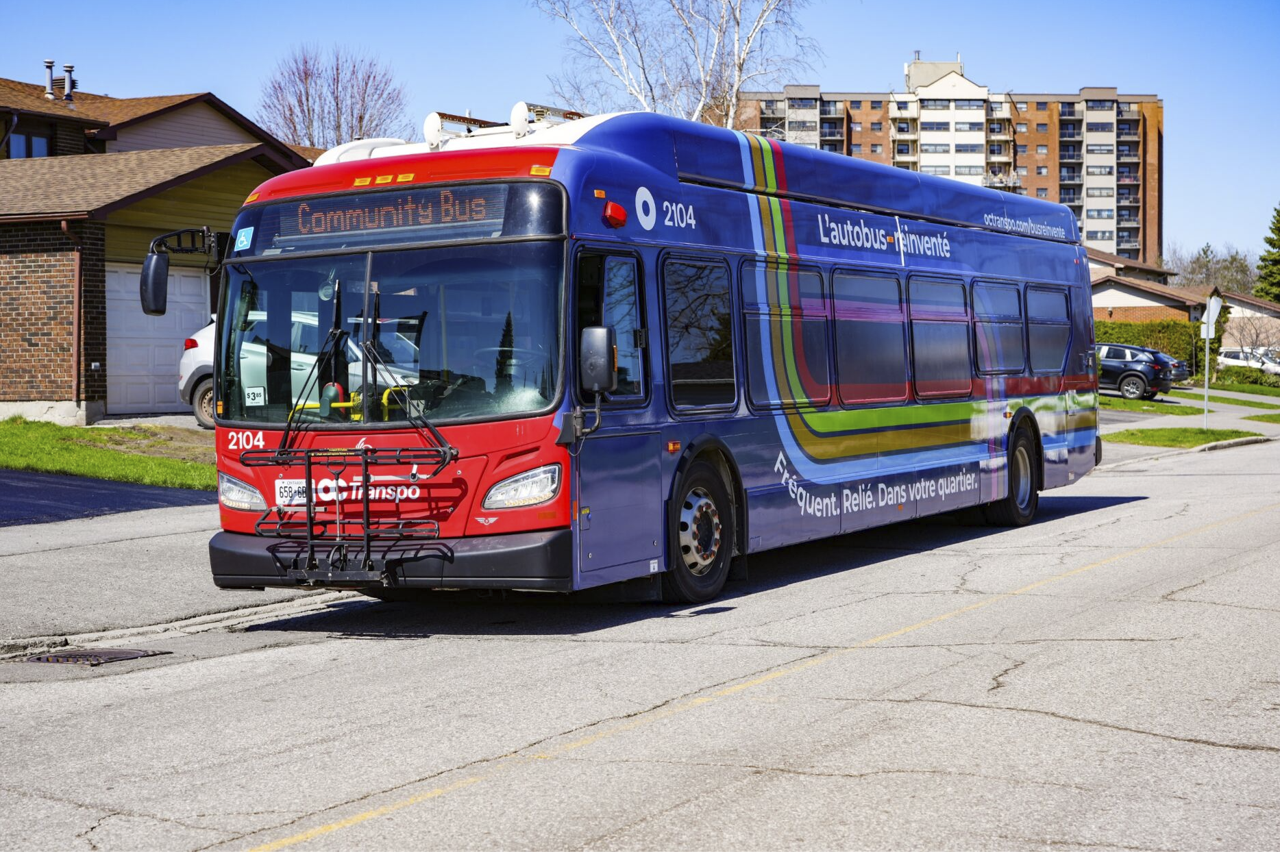
Keep an eye out for our Zero Emission Bus (ZEB).
Why have we redesigned the bus network?
OC Transpo's current bus network was designed to carry 100 million passengers each year. However, with recent ridership trends, we are currently on track to carry 70 to 75 million customer-trips in 2024.
In response to significant changes in ridership and in preparation for the opening of O-Train Lines 2 and 4, we have been working to ensure a frequent, local, and connected bus network. Visit the pages below to discover the work behind New Ways to Bus.
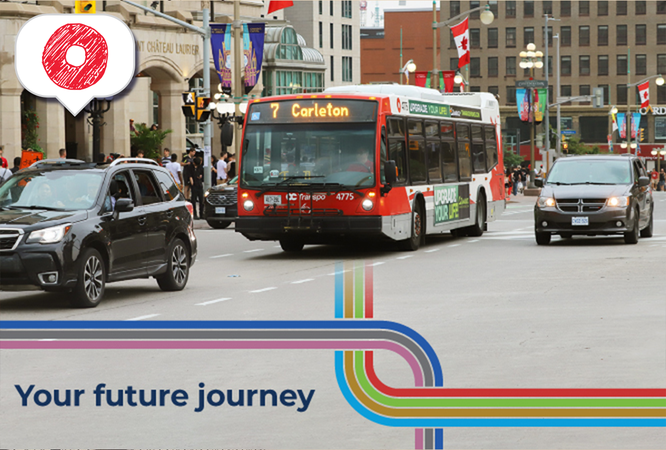
The Next Stop Blog
Our newest blog series – Your Future Journey, will help guide you through the upcoming changes to the bus network and answer your burning questions. Get a sneak-peek into what public transit will look like in different neighbourhoods once the new network is available.
What's behind your future journey?
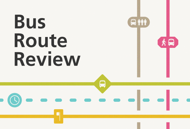
2023 Bus Route Review
Customer feedback and consultation was at the forefront of the review. We distributed multilingual surveys, facilitated multiple open houses, consulted major employers and post-secondary institutions, and gathered feedback from OC Transpo employees.
How did we review our bus network?
Questions?
For updates, keep checking the website or follow us on Twitter, Facebook, Instagram, or LinkedIn. If you have a question, please don't hesitate to send us an email at NewWaysToBus@ottawa.ca or call us at 613-560-5000.